VOICE provides a standard set of issue definitions configured for your geospatial quality control project. Each time you identify an issue and create a corresponding QC call, you’ll choose a call type and sub-type to precisely identify the issue.
For geospatial imagery projects, VOICE provides a standardized set of issues that apply to nearly all imagery quality control. If your instance of VOICE is configured for another data type (e.g., LiDAR or geospatial vectors), VOICE will display QC calls configured for your quality control project and data type.
Geospatial Imagery QC Definitions
VOICE divides imagery QC calls into three types of image anomalies. Anomalies are distorted areas within a geospatially referenced image. Most anomalies happen because images are scaled, stretched, rotated, and warped as imagery processing software corrects the tilt of the camera and accounts for relief displacement of the terrain. Almost all rectified imagery datasets contain some degree of anomalies. The severity of anomalies within a dataset depends on how much an image has to be scaled, rotated, and warped. Some anomalies are easily identified by reviewers and some require scrutiny to confirm validity or relevance.
Correcting anomalies may require a simple fix, like adjusting seamlines, or a time-consuming resolution, like using Adobe Photoshop to correct the distorted area. Categorizing anomalies in QC calls helps your geospatial imagery vendor quickly route issues to the correct software or technicians for issue resolution.
Seamline Anomalies
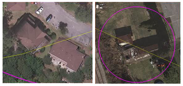
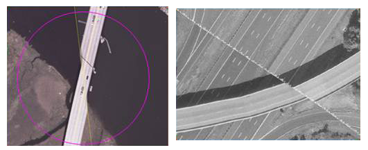
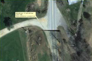
Seamline anomalies are distortions found along seamlines in your project’s imagery mosaic. A seamline represents the boundary between two coinciding image frames that were stitched together to create the final mosaic. Seamline anomalies typically occur when a seamline crosses an elevated feature, which creates a perspective change due to the camera angle. Your vendor can resolve seamline anomalies by moving the seamline.
Seamline Anomaly Types
Seamline Cuts Buildings
Seamline Cuts Bridges
Seamline Cuts Other Features
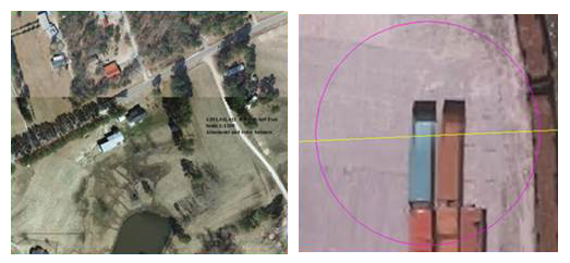
Image Ghosting
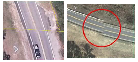
Misaligned Roads
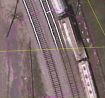
Misaligned Railroad Tracks
Blurriness

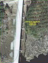
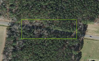
Elevation Anomalies
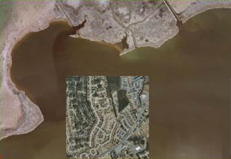
Elevation anomalies occur in areas where the elevation data used to process imagery contains errors and areas where changes over time create mismatches between the elevation data and imagery data. Elevation anomalies commonly occur near water bodies, where stray elevation data caused by water “pulls” pixels. Elevated bridges may cause elevation anomalies even in areas with valid elevation data.
Most elevation anomalies are easily observed because a feature in the images is distorted. Many times, elevation anomalies are resolved by adjusting the elevation data.
Elevation Anomaly Types
Twisted or Sunken Bridges

Twisted or Warped Roads

Twisted or Warped Railroad Tracks

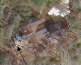
Warped Buildings
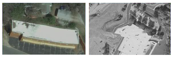
Image Warping
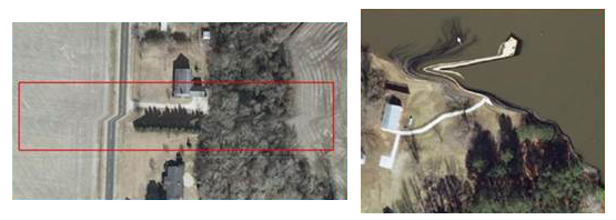
Image Anomalies
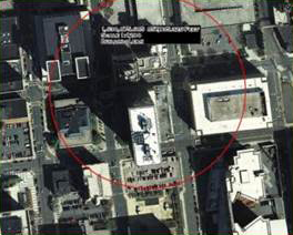
Image Anomalies can occur anywhere with an image. Most image anomalies occur in individual raw image frames and are not caused by orthorectification, scaling, stretching, rotating or warping during image processing. Vehicles are considered anomalies only when they appear to cause image artifacts or are not discernible as vehicles in the imagery.
Image Anomaly Types
Artifacts


Edge Displacement
Clouds and Smoke Obscuring Image

Buildings Obscuring Roads
Tile Misplacement
Blurry Images

Image Ghosting
Excessive Dodging and Tonal Balancing
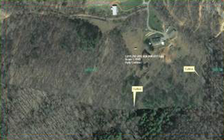
Image Anomalies Within Project Scope Requirements
In most imagery quality control projects, reviewers identify issues that fall within the quality scope of typical imagery production contracts. The following examples demonstrate typical reported issues that meet imagery project requirements and will be rejected by quality control screeners.
Tree lean is the most commonly reported issue in VOICE that causes a high percentage of rejects from screeners. Tree lean is often impossible to resolve because individual raw image frames all present some degree of tree lean.
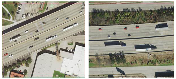
Ghosted or duplicate vehicles also produce a high percentage of rejects from screeners. Ghosting or duplicate vehicles typically result from seamlines placed down the middle of roads. However, especially in urban areas, the road centerline is the most practical choice for seamline placement. Screeners reject most vehicle duplicates or ghosting unless they create the perception of an indiscernible artifact. Depending on the type of sensor used to collect the imagery, there may also be instances where vehicles appear elongated or truncated based on the direction the vehicle was traveling in relation to the sensor. Screeners will also likely reject these issues.
Image Anomaly Types Within Project Scope Requirements
Isolated Tree Lean and/or Linear Stretch of Tree Lean Under 300’ or Dense Residential Canopy

Car Ghosting and Duplication


Vehicle Stretching and Truncating (Caused by Sensor Type)
Building Lean Less than 50%
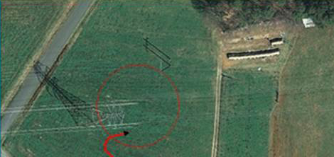
Elevated Power Lines
Elevated Cell Towers

Hydro Variations in Color
Variations in Tonal Balance Within Reason
0 Comments